The Spines of Forest
2021
(Landscape Planning, GIS, Bushfire Mitigation)
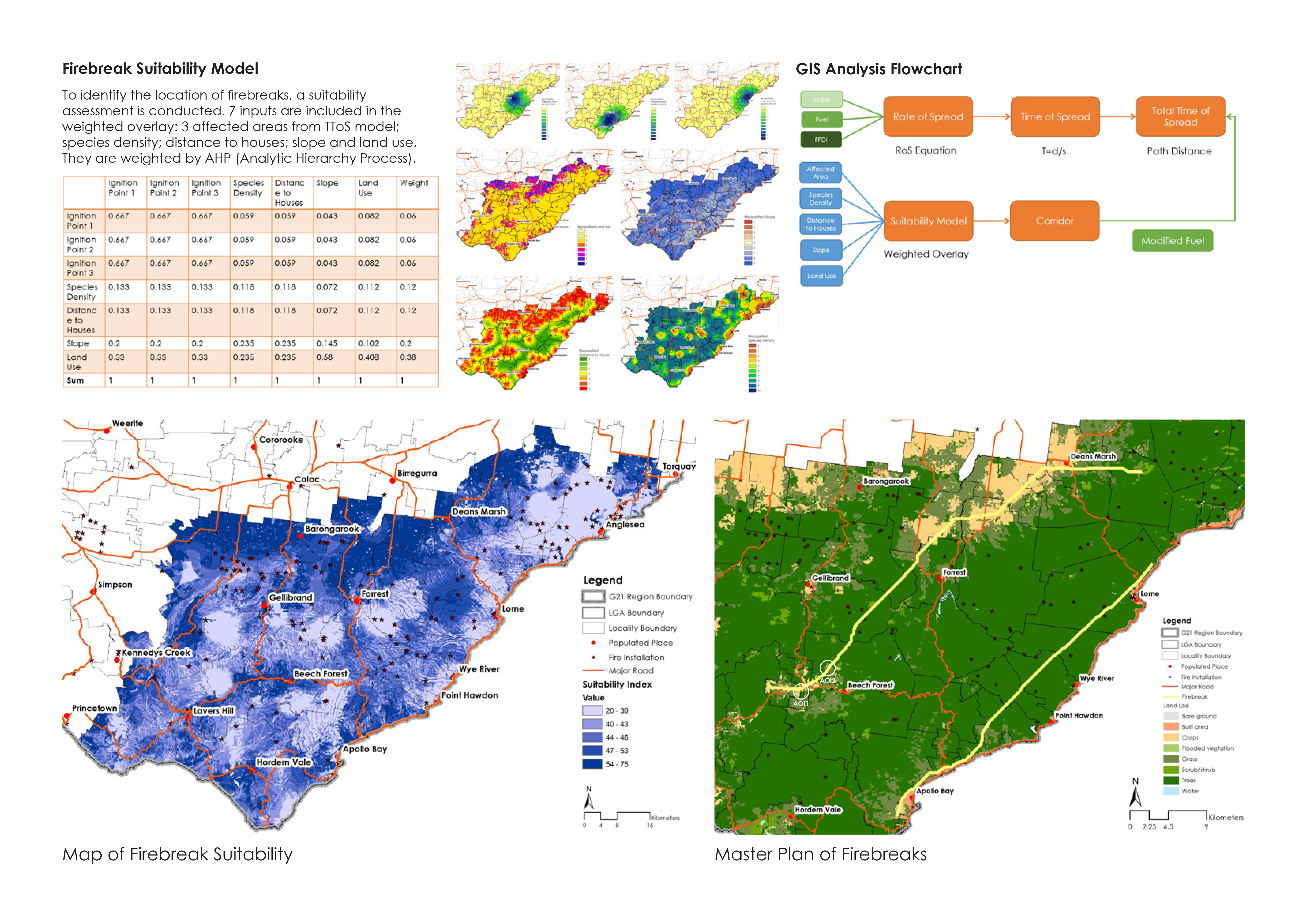
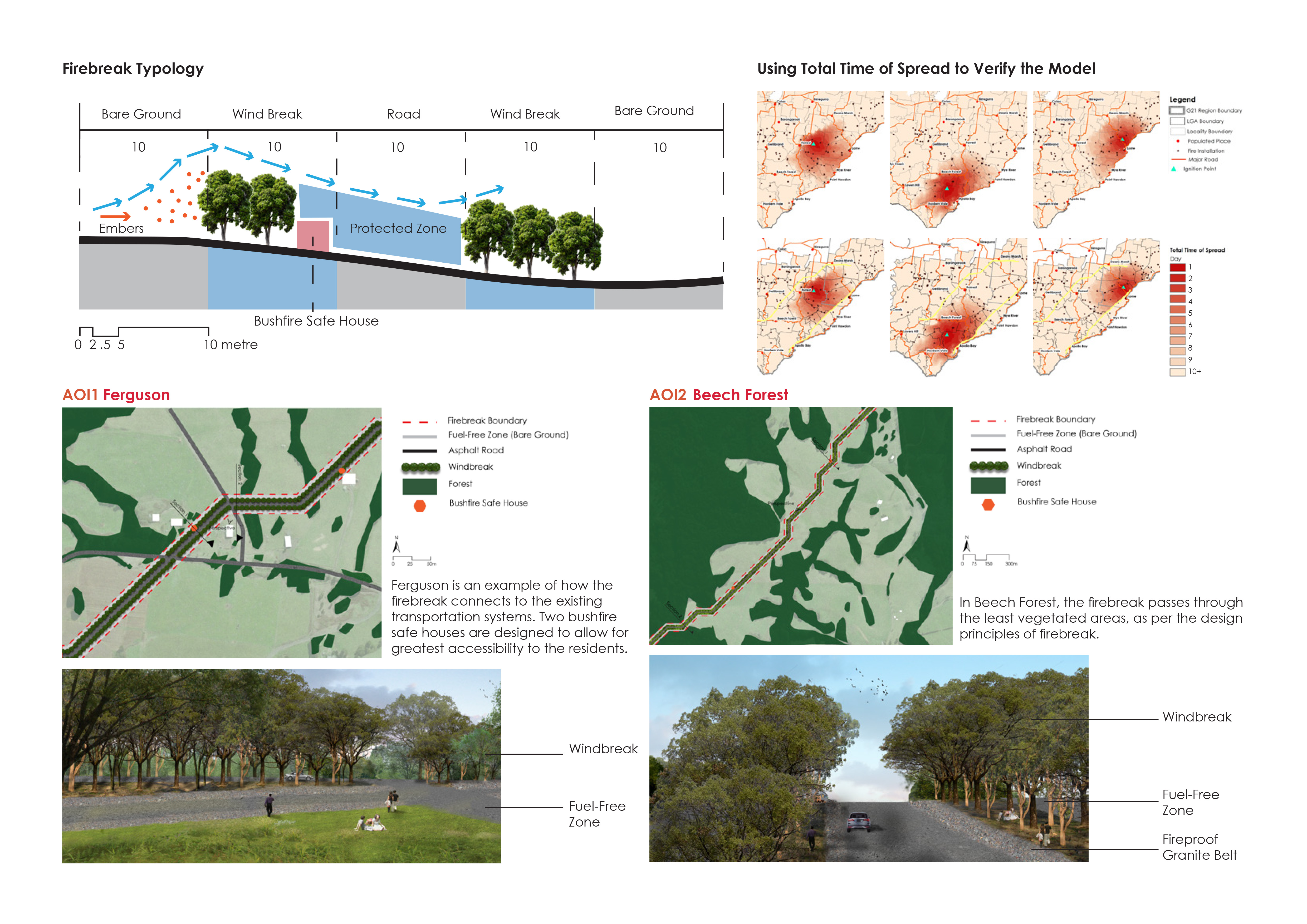
The Spine of the Forest is a landscape planning project in the Great Ocean Road area that focuses on bushfire mitigation through GIS modelling. Bushfire history is studied to understand the spreading and high risk ignite points of previous fires. Then using a rate of spread model to simulate the bushfires followed by a firebreak suitability model. The design proposes two firebreaks that postpone the impact on the towns and populated places in the Great Ocean Road area.